


Looking Beyond the Pond: How Satellite Intelligence Is Becoming a Practical Tool for Aquaculture 4.0

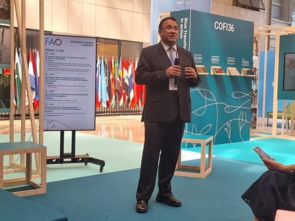
By Dr. Antonio Garza de Yta
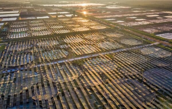
As climate variability increases, looking “beyond the pond” is no longer optional for capital-intensive production. Satellite applications provide scale and continuity, allowing stakeholders to estimate chlorophyll, nutrients, and turbidity. This digital infrastructure layer supports better feeding strategies and coordinated environmental governance, shifting the paradigm from isolated farm observations to comprehensive regional intelligence.
For decades, aquaculture has improved by looking inward. We became better at genetics, nutrition, health man, and farm design. These advances allowed the sector to intensify, professionalize, and grow. Yet, despite all that progress inside the pond, many of the decisions that define success or failure are still influenced by what happens outside it.
Temperature anomalies, rainfall concentration, watershed runoff, bloom dynamics, and coastal variability do not respect farm boundaries. They operate at larger spatial and temporal scales than ponds or cages. Traditionally, aquaculture professionals only became aware of these forces once their effects were already visible in dissolved oxygen, feeding response, growth, or survival.
Satellite imagery offers a way to close that gap. Not as a futuristic promise, but as a practical decision support tool that helps aquaculture understand what is happening around the farm and make better choices, earlier.
Satellite Intelligence Satellite imagery provides the spatial and environmental context Aquaculture 4.0 historically lacked. It helps explain why in-pond measurements behave specifically, allowing for earlier, better-informed choices regarding metabolic stress and growth.
What Satellite Imagery Actually Adds
Satellite imagery brings three capabilities that aquaculture historically lacked: scale, continuity, and spatial perspective. Satellites observe entire regions simultaneously, repeatedly, and independently of farm reporting. This allows producers, feed mills, financiers, and regulators to move from isolated observations to understanding patterns.
It is important, however, to be precise. Satellites do not measure water quality in the same way as in pond probes, and they do not provide continuous, minute by minute readings. Observations depend on satellite overpass and represent snapshots in time. The information is therefore indicative and dependent on the moment of capture.
That said, modern multispectral and thermal satellites, combined with calibrated models and algorithms, already allow the estimation of several biologically meaningful water quality variables at the pond surface. These include surface temperature, chlorophyll concentration, total suspended solids, dissolved organic matter proxies, salinity related conductivity, nutrient dynamics such as nitrogen and phosphorus, and indirect characterization of dissolved oxygen behavior through its main drivers.
This distinction matters. Satellites do not replace probes. They help explain why measurements behave the way they do.
Modern multispectral and thermal satellites estimate surface temperature, chlorophyll concentration, and nutrient dynamics. These indicators help anticipate metabolic stress and phytoplankton dynamics that drive daytime oxygen production and nighttime consumption.
What Can Be Done Today at the Farm Level
For farmers, satellite derived water quality intelligence provides context. A sudden change in feeding response or oxygen stability can be interpreted not only as a local issue, but in relation to regional temperature trends, bloom development, or hydrological events.
Surface temperature estimates help anticipate metabolic stress and oxygen solubility changes before critical situations occur. Chlorophyll monitoring provides insight into phytoplankton dynamics that drive daytime oxygen production and nighttime consumption. Turbidity and suspended solids trends indicate runoff, sediment resuspension, or organic loading that may affect water quality in the coming days.
This does not automate decisions. It supports better ones, such as whether to intervene immediately, monitor closely, adjust feeding strategy, or prepare for continued stress.
Feed Mills: From Reacting to Understanding
Feed mills operate portfolios of farms distributed across regions. Satellite imagery allows mills to assess whether challenges are isolated or systemic, seasonal or anomalous.
This enables earlier redeployment of technical teams, better prioritization of advisory efforts, and more informed management of commercial exposure. The value here is not control, but awareness. Knowing where conditions are changing allows better allocation of people, inventory, and credit.
Capital avoids aquaculture due to environmental uncertainty. Satellite-derived indicators allow financiers and insurers to contextualize production results with evidence-based risk assessments, grounding decisions in current environmental conditions rather than historical averages.
Finance and Insurance: Better Decisions, Not Blind Avoidance
Capital does not avoid aquaculture because of risk. It avoids aquaculture because of uncertainty. Satellite imagery introduces environmental visibility that helps explain variability in performance and outcomes.
When combined with farm telemetry, satellite derived indicators allow financiers and insurers to contextualize production results, calibrate exposure, and design structures based on evidence rather than assumptions. Decisions become grounded in what is happening environmentally, not only in historical averages.
Risk management improves as a consequence of better information, not fear.
Governments: System Level Awareness
For authorities, satellite imagery enables system level understanding. Instead of reacting after problems escalate, governments can observe emerging stress patterns across production zones, watersheds, or coastal areas.
This supports targeted advisories, coordinated responses, smarter zoning decisions, and more proactive environmental governance. Policy moves from reactive to preventive.
Integrating satellite imagery with inpond sensors turns isolated data into regional understanding. As climate variability rises, this external context layer becomes essential for managing metabolic response and ensuring longterm sustainability.
Why Satellite Imagery Strengthens Aquaculture 4.0
Aquaculture 4.0 is not about replacing experience with software. It is about integrating intelligence layers to support better decisions.
In pond sensors provide frequency and depth. Satellite imagery provides spatial and environmental context. Models and algorithms translate observations into indicators. Integration turns data into understanding.
Satellite imagery becomes the external context layer of digital infrastructure. It is essential, but not standalone.
Looking Ahead
Over the next decade, satellite applications in aquaculture will move from observation to prediction, and from farm level novelty to cluster and country level infrastructure. As climate variability increases and production systems become more capital intensive, understanding what happens beyond the pond will no longer be optional.
Satellites do not tell aquaculture what to do. They help aquaculture understand what is happening. And in a complex, variable environment, understanding is the foundation of good decisions and sustainable growth.

* Antonio Garza de Yta is CCO of Intelligon, Vice President of the International Center for Strategic Studies in Aquaculture (CIDEEA), President of Aquaculture Without Frontiers (AwF), Past President of the World Aquaculture Society (WAS), Former Secretary of Fisheries and Aquaculture of Tamaulipas, Mexico, and Creator of the Certification for Aquaculture Professionals (CAP) Program with Auburn University.
Apa Reaksi Anda?
 Suka
0
Suka
0
 Kurang Suka
0
Kurang Suka
0
 Setuju
0
Setuju
0
 Tidak Setuju
0
Tidak Setuju
0
 Bagus
0
Bagus
0
 Berguna
0
Berguna
0
 Hebat
0
Hebat
0