

































Machine learning maps avian influenza detection risk in Egypt
Researchers have combined wild bird sampling with environmental and disease data to map the probability of detecting avian influenza viruses across Egypt. Alongside the Nile Delta, the analysis points to southern and coastal wetlands where surveillance has so far been limited.
Egypt lies on migratory routes connecting Europe, Asia and Africa. Its wetlands provide important stopover and wintering sites for wild birds, which can carry avian influenza viruses over long distances.
A new study explores whether machine learning could help direct surveillance towards the areas where virus detection is more likely. The analysis covers wild bird populations; the occurrence of outbreaks in poultry was outside its scope.
H5 dominated the positive findings
Between 2019 and 2023, researchers sampled 1,087 wild birds belonging to 19 species. The work was carried out from September to January at four northern locations near water sources in Damietta, Port Said and Dakahlia.
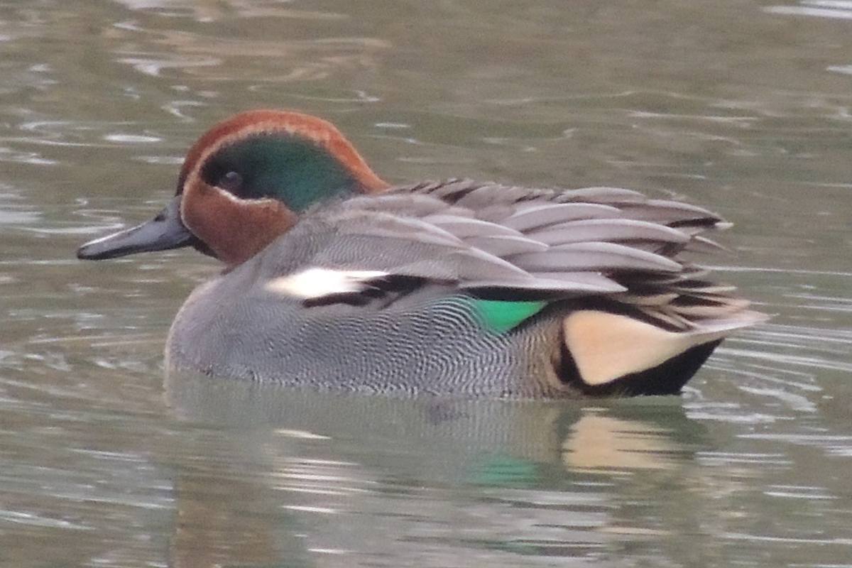
Oropharyngeal and cloacal swabs were grouped in pools according to species, sampling date and location. Six species were reported positive for avian influenza virus. Eurasian teal had the highest reported prevalence, at 12.3%.
H5 accounted for 70.3% of the AIV-positive cases reported in the study, while H9 represented 9.9%. H5/H9 coinfections were found in common moorhen, Eurasian teal and northern pintail.
The presence of different influenza subtypes in the same host can create conditions for genetic reassortment. Whether this occurred in the sampled birds was not investigated.
The RT-qPCR protocol identified the H5 subtype without determining its pathotype. The H5 detections therefore cannot be classified as either highly or low pathogenic from the evidence presented in the study.
Wetlands shape the winter map
The field findings were integrated with 7,710 historical records drawn from international animal health and bioinformatics databases. After records sharing the same date and location were consolidated, 219 sampling instances across 46 geolocations remained for the spatial analysis.
The model examined a range of variables, including temperature, humidity, precipitation, vegetation, proximity to water, elevation, land cover and estimated chicken and duck populations.
Relative humidity, temperature, vegetation and proximity to wetlands had the greatest influence. Poultry density, elevation and land-cover category were excluded during the model’s final variable-selection stage. Their wider epidemiological role cannot be judged from that result alone.
Wetlands offer favourable habitats for migratory waterbirds and can concentrate large numbers of potential hosts. Temperature and humidity may also affect the persistence of influenza viruses in the environment.
According to the researchers, some of the patterns captured by the environmental variables probably reflect seasonal changes in wild bird distribution. Detailed information on bird abundance and movements was unavailable for inclusion in the model.
Surveillance gaps beyond the Nile Delta
The winter projection, calculated for conditions around 1 January, showed the highest probabilities of AIV detection along the Nile River and in the Nile Delta.
Higher values also appeared around the wetlands of Lake Nasser, parts of the south-eastern Red Sea coast and the Siwa lakes in north-western Egypt. Historical surveillance has been limited in some of these areas, particularly around Lake Nasser and along the south-eastern coast.
They are possible priorities for further sampling. Their status as infection hotspots would need to be established through field surveillance.
The model produced its most consistent positive predictions along parts of the Nile. Areas of the western desert, where wetland habitat is scarce, were more consistently associated with negative predictions.
For 1 July, the geographical pattern became much more uniform. The authors link this result to more homogeneous summer conditions and seasonal differences in migratory bird presence. Since the model did not include direct measurements of wild bird abundance, this explanation remains tentative.
More data needed before operational use
Predictive performance was limited. The model recorded an AUC of 0.608 and an F1 score of 0.596, with better classification of negative records than positive ones.
The underlying data also had a clear geographical imbalance. Records were concentrated around Damietta and Port Said, while large parts of Egypt had received little sampling. Information on seasonal changes in wild bird abundance and diversity was also lacking.
At this stage, the map is best viewed as a guide for further investigation. Its most useful contribution may be the identification of places that existing surveillance has overlooked.
Sampling in the southern and coastal wetlands would test whether the predicted pattern holds beyond the Nile Delta. Combined with better data on wild bird movements, those results could provide a stronger basis for planning future avian influenza surveillance.
Source: Nabil, N.M. et al. (2026), “Molecular surveillance and predictive risk modelling of avian influenza virus in wild birds in Egypt”, Journal of General Virology, 107:002278. The original article is distributed under a Creative Commons Attribution licence.
Text summarized and editorially adapted by the Zootecnica – Poultry Magazine editorial team.
Apa Reaksi Anda?
 Suka
0
Suka
0
 Kurang Suka
0
Kurang Suka
0
 Setuju
0
Setuju
0
 Tidak Setuju
0
Tidak Setuju
0
 Bagus
0
Bagus
0
 Berguna
0
Berguna
0
 Hebat
0
Hebat
0